STEP Matters 199
- Default
- Title
- Date
- Random
- It is estimated that there are fewer than 21,000 koalas left in NSW. The population may have reduced by more…Read More
- Australia’s total population grew by 390,000 over the year to 30 June 2018. In August 2018 Australia’s population hit the…Read More
- The Beecroft Cheltenham Civic Trust has been working for the local community for many years, keeping them informed about local…Read More
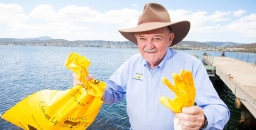
- Clean Up Australia was founded 30 years ago by Ian Kiernan. It is sad to hear of his death in…Read More
- In Issue 198 of STEP Matters we described the latest application by the Hills Council through the Gateway Process to…Read More
- Lane Cove National Park will be expanded, albeit marginally, with the addition of 0.6 ha near the river at North…Read More
- We have all been shocked by the mass killing of fish in the Menindee Lakes and other areas in January,…Read More
- Frances O’Brien worked as the Environmental Officer at Wahroonga Waterways Landcare for four years and has written a book about…Read More
- It may not look like a pristine expanse of Amazon rainforest or an African savannah, but the patch of bush…Read More
- We have been alerted to a perplexing situation by a Streamwatch volunteer. Streamwatch was established in 1990 by Sydney Water…Read More
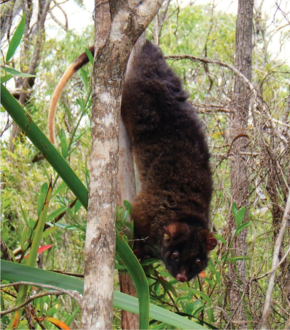
- The participants of John Martyn’s walk in the Watagans on 5 December 2018 were treated to some great views of…Read More


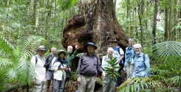
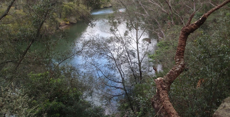
Watagans Walk was Spectacular

The participants of John Martyn’s walk in the Watagans on 5 December 2018 were treated to some great views of the coast of the upper Hunter and some magnificent rainforest. There is often not much plant variation in the rainforest understorey but not in this case. It was special to be able to see several large red cedars (Toona ciliata var. australis) that had escaped the ravages of the foresters.
Ian Kiernan AO, Founder of Clean Up Australia

Clean Up Australia was founded 30 years ago by Ian Kiernan. It is sad to hear of his death in October 2018.
While sailing in the BOC Challenge solo round the world yacht race Ian was shocked and disgusted by the pollution and rubbish that he continually encountered. Back in Sydney Ian organised a community event with the support of a committee of friends.
300,000 volunteers turned up to the first event in 1990. This simple idea of cleaning up Sydney Harbour has now become the nation's largest community-based environmental event, Clean Up Australia Day.
Clean Up the World was launched in 1993 with the support of the United Nations Environment Program. Now about 30 million people participate from 30 countries.
STEP has supported Clean Up Australia Day since 1993.
Congratulations to Ross Walker OAM
The Beecroft Cheltenham Civic Trust has been working for the local community for many years, keeping them informed about local developments, advocating for preservation of heritage buildings and the environment, organising community events and so much more.
Current president Ross Walker who has been actively involved with the Trust for the past 25 years has been recognised in the Australia Day Honours for his leadership and has been awarded a Medal of the Order of Australia in the General Division for Services to the Community.
As the Election Looms the NSW Government makes some (Small) Environmental Announcements

It is estimated that there are fewer than 21,000 koalas left in NSW. The population may have reduced by more than a quarter over the past 20 years. The species is listed as vulnerable to extinction under the federal EPBC Act in NSW.
The major reason for the decline is habitat loss with the worst areas being in the Pilliga and South Coast. NSW is a heavily cleared landscape. Almost 40% of native forests and bushland has been removed since European settlement, and only 9% of remaining vegetation is in close-to-natural condition.
Eastern Australia is one of the world’s top 11 deforestation hotspots, along with the Amazon, Borneo and the Congo according to a report prepared by the NCC and WWF. Between 1990 and 2016, at least 2 million hectares of forest and bushland in NSW have been destroyed out of the total state area of 81 million hectares.
So what is being done about this? There are a number of decisions over recent years that will make the situation worse:
- As a result of the new biodiversity laws implemented in 2017, 99% of identified koala habitat on private land can be bulldozed.
- Last November the government commenced new logging laws called Integrated Forestry Operations Approvals. The laws reduce protections for forest wildlife, including koalas. One of the worst changes is the introduction of an intensive harvesting zone over 140,000 ha of coastal forest between Taree and Grafton. The intensive harvesting zone will see large-scale clear-felling legalised on the north coast for the first time. Because most of the trees will be gone, it’s likely that most of the koalas will be too!
- In December the Premier Gladys Berejiklian gave the green light to renew the Regional Forest Agreements (RFAs) with the Commonwealth for another 20 years. RFAs are the mechanism by which the states are permitted to log native forests under accreditation from the Commonwealth. They are meant to balance the needs of the logging industry with conservation and public recreation. Conservationists argue that the RFAs have not been properly reassessed with a thorough scientific analysis of the values of native forests, for example for carbon storage and enhancement of catchment water.
NSW Koala Strategy
One positive development, albeit with limitations, is the government announcement last May of a strategy aimed at securing the future of koalas in the wild. $45m has been committed. It involves:
- setting aside 20,000 ha of state forest as koala reserves on the Central Coast, Southern Highlands, North Coast, Hawkesbury and Hunter
- transferring 4,000 ha of native forest on the North Coast to national parks
- allocating $20m to purchase prime koala habitat that can be added to national parks
However the strategy fails to commit to protecting areas known to be home to koalas from a major intensification of logging in state forests under new IFOA laws.
In early February 2019, as the election looms, some parts of the strategy have been implemented. A cattle property once used as a recreational dirt motorbike and horse recreation area has been bought by the NSW government to become part of the first national park to be gazetted in NSW in 11 years. It borders the Wollondilly River in the Southern Highlands and is about 3,680 ha. Actually 1,150 ha of this land is already protected so the addition is only 2,164 ha. There is no information about how much of this area is currently cleared and degraded from its previous use. How long before it becomes genuine koala habitat?
Great Koala National Park is a Better Idea
The National Parks Association has developed a proposal that will provide definite security for koala populations. This is for a 175,000 ha Great Koala National Park on the NSW mid-north coast, new national parks for the last remaining koala populations in southwest and western Sydney, or new national parks in other areas of known koala significance. The choice of the north coast has been confirmed as most effective by studies completed by the Office of Environment and Heritage, copies of which were obtained under Freedom of Information laws.
Funding Announced for Improvements to Popular National Parks
Another government announcement is for a $150m investment to improve access to existing national parks that includes upgraded walking tracks, better visitor facilities and new digital tools such as virtual tours and live-streaming cameras. The main investment is in the Blue Mountains and Royal National Park where visitor numbers have increased rapidly. This is all aimed at the tourist dollar, not conservation that is meant to be the main purpose of national parks.
Will there be an increase in funding for the National Parks and Wildlife Service to look after the additional reserves? After the massive cuts in funding of the service highlighted in previous issues of STEP Matters one wonders!
Removal of Feral Horses from Kosciuszko National Park has been Stopped
In December the NSW Threatened Species Scientific Committee declared feral horses to be a key threatening process because they place dozens of species at risk closer to extinction. In response a spokesman for Environment Minister Gabrielle Upton said the government was preparing a plan of management that would:
identify the heritage value of sustainable wild horse populations and set out how those will be protected while maintaining environmental values.
That goal will be impossible to achieve.
Meanwhile, in response to the passing of the Wild Horse Kosciuszko Act, the number of feral horses being removed by current methods has been reduced to nil since August 2017 even though the Act was not passed until June 2018. The Invasive Species Council has obtained data showing that the peak number of removals was 600 in 2012.
The Nationals Parks and Wildlife Service in 2016 estimated there were 6000 brumbies in Kosciuszko National Park. Scientists estimate the population may grow by up to 20% a year. The drought though is believed to have curtailed brumby numbers.
Labor has committed to repeal the legislation to protect the brumbies.
IBM Site in West Pennant Hills – What about the Koalas?

In Issue 198 of STEP Matters we described the latest application by the Hills Council through the Gateway Process to change zoning and planning conditions applicable to the former IBM site now owned by Mirvac.
In December 2018 the Department of Planning gave council the go ahead to proceed with the public consultation process without any further amendment to the current plan. They have until 31 July to get started.
One of the issues with the current proposals is that there seems to be no agreement on who will look after the forest in the E2 zone that has been agreed to by council and Mirvac. Now there might be an answer. The Forest in Danger group understands that the NSW government is looking to join the forest part of the Mirvac site to the Cumberland State Forest. The Forestry Corporation (which runs the Cumberland State Forest) ‘co-incidentally’ just put out a Draft Plan of Management. We think the two matters are linked – that the Forestry Corp may need this plan of management to be able to take on the Forest.
Now there are reports of koala sightings in the Cumberland State Forest. There is nothing to stop them wandering into the Mirvac site.
We will be watching out for council release of the documents for the consultation and what they have to say about the koalas. Ecological reports were missing from the earlier consultation.
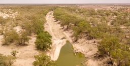
Murray-Darling Basin Plan: Too Little, Too Late

 We have all been shocked by the mass killing of fish in the Menindee Lakes and other areas in January, the loss of wildlife and the poor water quality and quantity for communities along the Darling River. Murray Cod and other native species believed to be up to 100 years old that have survived numerous droughts have not survived this one. The politicians are blaming the drought but the causes of the severe degradation of the Darling River go back a long way stemming from the over exploitation of the water and the lack of political will to solve the problem.
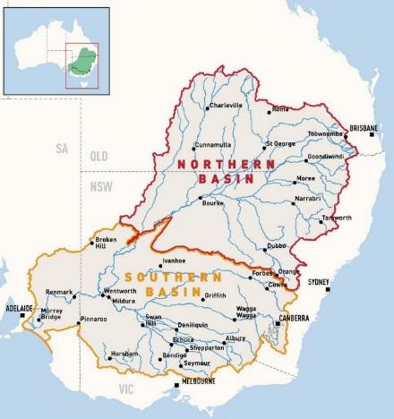
The Murray-Darling Basin covers a massive area of southeast Australia inland from the Great Dividing Range, from southern Queensland through to the mouth of the Murray in South Australia (see map).
Water extraction for irrigation commenced late in the 19th century along the Murray River with the creation of schemes by the Caffey brothers near Mildura and Samuel McCaughey in the Murrumbidgee Valley. Regulation of the Murray River system was one of the first issues addressed after Federation.
With a severe drought in the late 1960s, environmental impacts were starting to emerge as water quality had deteriorated and salinity was apparent. From the 1970s state governments undertook initiatives to manage water diversions including the definition of water entitlements, development of water markets and salinity management, but there was no interest in the fundamental issue of too much water being used.
By 1995, in response to increasing evidence of deterioration of the Basin’s river system including a massive blue-green algae outbreak in 1991–92, the Murray–Darling Basin Ministerial Council directed that a water audit be prepared to investigate the current levels of water use and potential increases across the Basin if infrastructure was developed so that all available entitlements were taken up.
The audit showed that between 1988-89 and 1992-93 the average total diversion from the Basin was 10,780 GL/year. Of this amount, over 95% was diverted for irrigation.
The report modelled the hypothetical flows of water at the mouth of the Murray. With no diversions drought conditions would have occurred in 1 in 20 years, but with the current level of diversions drought conditions would occur in 60% of years, and under full development it would occur in 3 out of 4 years.
 This graph shows the massive increase in the water used for irrigation and agriculture as revealed in the audit report. It showed that growth even in the previous 8 years had been 8%, mostly in the north for cotton growing. Not only that, there was the potential under the current management regime for usage to grow by a further 14.5% if the infrastructure capacity were installed. However use of the full entitlements would reduce the overall security of the system for individual irrigators because the levels of reserves in storages would be reduced. The full entitlements equated to diversion of 12,344 GL per year.
Environmental Impact of Current Extractions
The 1995 audit reported that the changes to the natural flow regime from the current water diversions and extractions had had a significant impact on river health. There was a reduction in the areas of healthy wetland, native fish numbers had declined in response to the reduction in flow triggers for spawning and salinity levels had risen. Algal blooms had increased in frequency in line with more periods of low flow leading to increased water temperatures and nutrient levels. The fish kills occur when the temperature changes and the algae die off and the bacteria increase reduces oxygen levels available to fish and other aquatic life.
First Plan to Control Extractions, the Cap
In 1995, the Murray–Darling Basin Ministerial Council introduced the Murray–Darling Basin Cap on Surface Water Diversions (the Cap):
to protect and enhance the riverine environment and protect the rights of existing water users.
The Cap introduced long-term average limits on how much water could be taken from rivers in 24 designated river valleys. The total Cap was 12,100 GL per year based on possible extractions in the 1993-94 year under infrastructure then available with some adjustment for the development of new diversions outside the main states of NSW and Victoria. This total extraction each year was to be adjusted to allow for actual rainfall. With the Cap in place, new developments were allowed, provided that the water for them was obtained by improving water use efficiency or by purchasing water from existing developments.
The Cap made water in the Basin a more valuable resource as it gave entitlements to its diversion more value and saw increased trade in these entitlements. The Cap was meant as an emergency measure to prevent further disasters while a long-term policy was worked out. Nearly 25 years later, it is still in effect.
The Cap is too High
The millennium drought from the late 1990s to 2010 in much of the Basin highlighted the need for continuing reform. Too much water was still being used and the environment was suffering.
In 2007, Prime Minister John Howard announced a $10b plan to improve water efficiency and to address over-allocation of water. The Water Act was passed that set up the Murray–Darling Basin Authority (MDBA) with the purpose of developing the Basin Plan. The Act’s primary objective is:
to bring water extractions back to sustainable levels in order to protect, restore and provide for the ecological values and ecosystem services of the Murray–Darling Basin
The Act should give effect to Australia’s international agreements such as the Ramsar wetlands. The ultimate source of conflict in implementation of the Act was the provision that management should optimise economic, social and environmental outcomes.
Contents of the Plan
In October 2010, as part of the preparation of the Basin Plan, the MDBA produced a report for discussion entitled Guide to the Proposed Basin Plan. The scientific evidence described in the report stated that achieving an ecologically sustainable level of take would require the recovery of between 3,856 GL ± 20% (high uncertainty of success) and 6,983 GL ± 10% (low uncertainty of success) of surface water from the current baseline development level of consumptive use of 13,623 GL. 10,900 GL of this baseline development level was extracted for irrigation and the remainder was run off stored in on farm dams.
The irrigation communities objected violently to the idea that their allocations could be reduced by so much. The MDBA and politicians buckled and in 2012, the Basin Plan passed by parliament was for a water recovery target of only 2,750 GL (by June 2019), with a program to recover an additional 450 GL of water (by 2024) to benefit South Australia through ‘efficiency measures’ (reducing water losses via infrastructure improvements rather than buying back entitlements), bringing the total to 3,200 GL.
What about Climate Change?
In preparing the Plan in 2010 the MDBA also asked CSIRO to prepare a report modelling water availability in the Murray–Darling Basin including a projection of the effects of climate change.
The assessments for climate change scenarios were made for the median model at 2030 and for the ‘dry extreme’ and ‘wet extreme’. The median projection was of a 10% reduction in Basin-wide water availability with a range of –27% (dry extreme) to +9% (wet extreme).
So not only was the Plan the bare minimum with great risk of not achieving the necessary improvement in environmental flows, there was no allowance for adjustment for the impacts of rainfall reduction from climate change.
Unwinding of Water Recovery Targets since 2012
As has become apparent the Basin Plan is too little, too late. To make matters worse the state and federal governments have been fudging the implementation of the Plan that was always going to require dedication and strict administration.
There are several instances of improper governance and attempts to water down (pun, sorry!) the Plan. A few are outlined below.
In July 2017 ABC’s Four Corners aired a story of water theft and lack of proper oversight allowed by the NSW government. Some prosecutions followed but the administration has been laissez faire.
The Four Corners report prompted the South Australia government to hold a Royal Commission. The report just released condemns the MDBA and governments for maladministration of the Water Act and calls for a separation of management and compliance.
A series of policy changes since 2012 are threatening to further undermine the possibility satisfying the objectives of the Basin Plan. The Australian government intends to amend the Basin Plan by increasing surface water extraction limits for irrigation by 70 GL in the northern Basin. After NSW and Victoria threatened to abandon the Plan water extraction limits in the southern Darling Basin were increased by 605 GL on the basis of 36 projects that improve water efficiency but so far the MDBA has failed to demonstrate that they will achieve genuine water saving. Progress in getting the extra 405 GL to South Australia seems non-existent. Water buy-backs have been halted in favour of these so-called efficiency projects.
The Menindee Lakes fish kill is another story relating to a plan to change the water flow and reduce evaporation, too complicated to explain here but another example of mismanagement. Read a report on this from the Australian Institute.
The federal and state government ministers responsible for the success of the Act have actively undermined the Plan.
Fish Strategy Killed Off
Another concerning demonstration of disregard for science is the treatment of the Native Fish Strategy. This was developed in 2001 and lays out a plan for helping the Basin’s fish communities to recover. The MDBA produced a report in 2009 showing fish stocks were at 10% of pre-European levels (0% in some parts) and the objective of the strategy was to bring this back to 60% over 50 years. It was visionary and forward-thinking – contributed to by a multitude of scientists, managers, indigenous groups and Basin communities.
But direct funding ceased in 2012 when NSW pulled out 60% of its funding. Since then, implementation of its recommendations has been opportunistic and without central coordination. Science ignored again!
Conclusion
Even before the Plan is due to be fully implemented it has been shown to be totally inadequate. Taxpayers that have already paid billions of dollars for water buybacks now have to bear the cost of river rehabilitation, clean up of fish kills and assistance to river communities. The politicians must have the fortitude to strengthen the water take restrictions. We hope the recent events will convince the sceptics and vested interests that stronger action is needed for the common good.
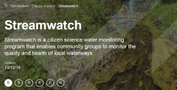
Uncertain Future for Streamwatch

We have been alerted to a perplexing situation by a Streamwatch volunteer. Streamwatch was established in 1990 by Sydney Water and since has been managed by the Australian Museum which runs it under its citizen science programs.
Streamwatch volunteers monitor our waterways and deliver scientifically accurate data on water quality and biology, mentor students, alert authorities on pollution events, collect litter, provide biosecurity surveillance and provide a historical record of how waterway health has tracked over time. The program engenders understanding and stewardship of our bioregion's ecosystems.
And what does it cost to run? A mere $100,000 per year. It is an incredibly cost-effective program.
Recently the Australian Museum announced that it will no longer support the program and it appears that Sydney Water will cease funding after 30 June 2019. An Australian Museum spokesperson said the museum is committed to identifying a new organisation to take over operation of the project by July 2019 but, if future funding is not assured, it will most likely close down.
Streamwatch is so much more than a data collecting exercise, in fact it's so much more than a typical citizen science program. People may think that between Sydney Water, OEH and the EPA, Sydney's freshwater systems are monitored and protected but these authorities cannot be everywhere. Streamwatch has repeatedly been the first alert organisation for pollution events. Skilled members of the public perform a brilliant service to the community. The scheme also gives school children an opportunity to engage in real hands on science.
The Australian Museum currently has around 170 volunteers testing at 160 sites in Sydney, the Blue Mountains and the Illawarra. Streamwatch groups are made up of community volunteers, TAFE and university students, council staff and high school teachers. In the last 12 months alone 796 data sets have been uploaded to the Streamwatch database making almost 5000 data points.
Streamwatch volunteers have started an online petition calling for the NSW government to ensure that the program continues. Please sign the petition.
Australia’s Population hits 25 million but who is Cheering?

Australia’s total population grew by 390,000 over the year to 30 June 2018. In August 2018 Australia’s population hit the 25 million mark. Even before that milestone was announced public concern about the rate of population growth has increasingly focused on the shortcomings of infrastructure in Sydney and Melbourne. Even the Liberal government has been canvassing the possibility of reducing the level of immigration and has established a committee to review the current level of the intake.
However the issue is still being treated as a short-term problem so we can return to business as usual once the backlog of construction has been overcome. The idea of reducing permanent immigration even by 40,000 from the recent levels of around 200,000 pa has generated fear mongering of a calamitous reduction in economic growth. This highlights the artificial situation that has been created whereby our economic growth is dependent on population growth. The touted price-adjusted GDP growth rate of 2.6% pa over the last 5 years is only 1.0% pa on a per capita basis according to Reserve Bank data.
The majority of people recognise the success of immigration in enhancing the development and culture of the country but that is not the point. No one is proposing that immigration stops altogether. In fact a large number of people leave the country each year.
Let’s put the current situation into perspective. The table below gives some historical data of past migration rates.
10 year periods (ending 30 June) | Average net overseas migration pa |
2009–18 | 221,700 |
1999–08 | 144,700 |
1989–98 | 86,500 |
This demonstrates the huge growth in net migration over the past ten years. I don’t recall the economy being a disaster last century when net migration was below 100,000 pa.
Some Facts and Figures
We need to explain some of the detail of the definition of population. Changes in population are estimated from data of births and deaths (natural increase) and net overseas migration (NOM). Every four years a census is taken to balance the books and check the accuracy of the estimates.
The calculation of NOM is not easy. The figure of NOM is made up of permanent and temporary net migration. Immigrants are counted in NOM if they have been resident for 12 out of last 16 months. Conversely if a person leaves the country they are still counted in the population until they have been out of the country for 4 months. This applies to permanent citizens and visa holders and also temporary residents.
The NOM figure for 2017–18 was 237,000 and 263,000 in 2016–17.
The government defines a cap on permanent immigration that covers the aggregate of two groups; migrants that have arrived as permanent new residents or temporary migrants already resident in Australia can be granted permanent residency. The major criteria for admission are broadly broken up into two streams based on skill or family reunion. The total cap for permanent migration is currently 190,000. The actual number approved in 2017–18 was 162,000. Humanitarian entrants come under a separate policy and total about 20,000 pa.
The government committee is currently reviewing the 190,000 cap.
Temporary Visa Holders
The count of population includes a significant number of people on temporary visas. The main categories are temporary work visas (skilled workers, recent graduates who can stay for a fixed period, and working holiday visitors), students, bridging visas and a high number of New Zealanders who can come and go as they please. It appears that there is little control of the numbers of students. The government is bowing to pressure from educational institutions for more and more fee-paying students. As at 30 June 2018 the number of temporary residents is estimated to be more than 1.8 million. Including over 500,000 students. As explained above some of these people are counted in the official population figure.
One issue with the growth in the number of students is the pressure this creates for growth in the number of permanent migrants. Most students are allowed to stay on a temporary visa for some time after graduation and many apply for permanent residency. These new residents plus the large number of recent migrants create pressure for more and more family reunion visa. The whole system is a perpetual cycle of increase.
Still all this does not mean that is impossible to slow down!
Projection of Future Growth
The Bureau of Statistics recently released a new set of projections of future population over the next 50 years. The three major sets of assumptions used are as follows.
Scenario | Net overseas migration | Total fertility rate (average | Life expectancy | |
Male | Female | |||
A | 275,000 | 1.95 | 87.7 | 89.2 |
B | 225,000 | 1.85 | 83.0 | 86 |
C | 175,000 | 1.65 | 83.0 | 86 |
Current experience | 1.8 | 80.4 | 84.6 | |
The ABS has been instructed to assume continuation of high rates of immigration. Scenario B represents approximately the experience over the past ten years.
The projected outcomes are as follows for Scenario B.
Location | Projected population at 30 June (millions) | ||
2017 | 2036 | 2066 | |
Australia | 24.6 | 33.2 | 42.6 |
Greater Sydney | 5.1 | 7.0 | 9.7 |
Greater Melbourne | 4.8 | 7.0 | 10.2 |
Greater Brisbane | 2.4 | 3.4 | 4.8 |
By comparison the NSW government is working with an assumption of a population of 6.7 million for Greater Sydney by 2036 and the Victorian government is assuming 6.5 million for Greater Melbourne by 2036. There is a chronic under-estimation of the proportion of migrants, particularly students moving to Sydney and Melbourne.
Based on these projections governments are expecting the country to provide for an extra 8.6 million citizens over the next 20 years and a further 9.4 million over the following 30 years. That’s the creation of another one and a half Sydneys in only 20 years! Where will all these people live? This is a huge imposition on our fragile ecosystems and water supply and the demand for capital to finance the infrastructure needs.
The population debate is still dominated by commentators arguing that migration has been great for the country citing various success stories. This misses the point that it is not a simple black and white issue. Of course business and the construction industry are in favour of more and more growth but that ignores the views of current citizens who cannot visualise what the country will be like with that many people.
Planning is being done in short-term bursts, a few apartment blocks here, densification of some low-density housing areas with loss of trees, clearing of bushland on the fringes of towns and cities. We are in denial of the effect short-term decisions have on longer term outcomes. The longer the high growth continues the harder it is to cut back on employment dependent on growth such as construction and education. The existing residents of Sydney and Melbourne are suffering from congestion. We need a broader discussion.
Can Stabilisation be Achieved?
Back in 1998 the ABS did a projection of the conditions under which population would stabilise. This showed that net migration of 70,000 pa would lead to stabilisation at 23.5 million in about 2050. We are miles off that figure now and the net migration figure would need to be lower to achieve stabilisation in any foreseeable timeframe.
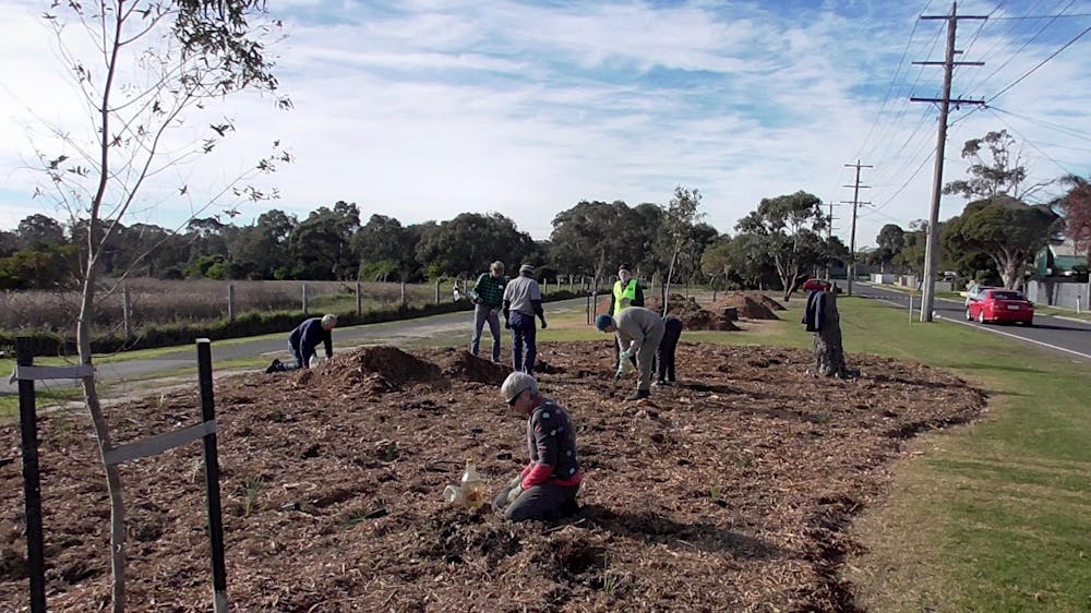
The Small Patch of Bush over your Back Fence might be Key to a Species’ Survival
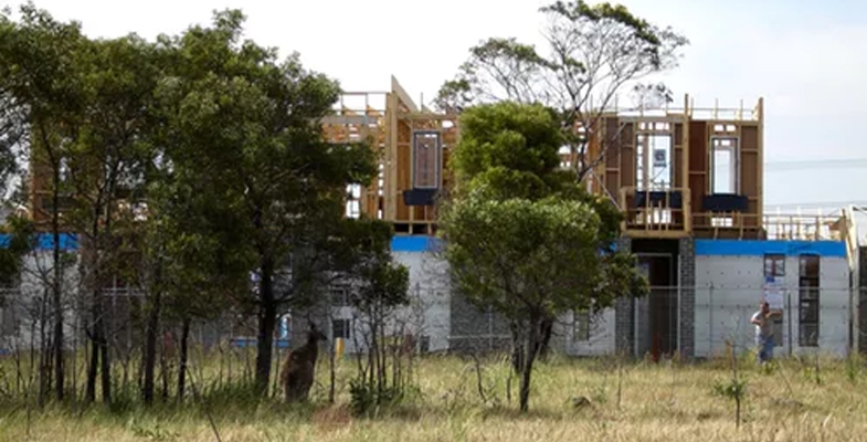
It may not look like a pristine expanse of Amazon rainforest or an African savannah, but the patch of bush at the end of the street could be one of the only places on the planet that harbour a particular species of endangered animal or plant.
Our newly published global study of the conservation value of landscapes in 27 countries across four continents has found these small patches of habitat are critical to the long-term survival of many rare and endangered species.
In Australia, our cities are home to, on average, three times as many threatened species per unit area as rural environments. This means urbanisation is one of the most destructive processes for biodiversity.
It tends to be the smaller patches of vegetation that go first, making way for a housing development, a freeway extension, or power lines. Despite government commitments to enhance the vegetation cover of urban areas and halt species extinctions, the loss of vegetation in Australian cities continues.
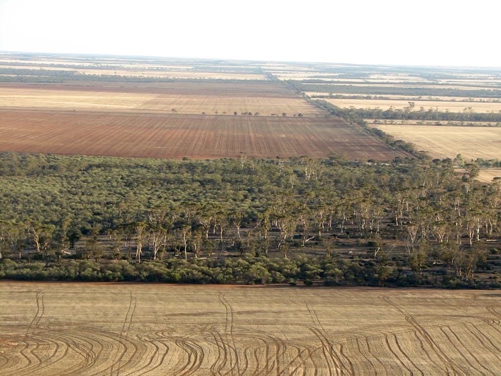
This story plays out all over the world day after day. Of course, it’s not just an urban story. Patches of rural vegetation are continually making way for, say, a new pivot irrigation system or a new mine to provide local jobs.
Mostly, policymakers and scientists do not consider these losses to be, on their own, a fatal blow to the biodiversity of a region or country. Small, often isolated patches of vegetation are considered expendable, tradeable, of limited ecological value due to their small size and relatively large amount of “edgy” habitat. Wrong.
Research forces a rethink
Our study analysed the relationship between conservation value of vegetation patches and their size and isolation in landscapes across Europe, Australia, North America and Africa. The findings prompt a rethink of long-held views about the relative importance of small, isolated habitat patches for biodiversity conservation. We show that these patches often have unique ecological and environmental characteristics.
That’s because they are the last patches left over from extensive clearing of flat, fertile land for agriculture or urban growth close to rivers and bays. They often contain habitats for rare or endangered species that have disappeared from the rest of the landscape. This makes these small, isolated patches of habitat disproportionately important for the survival of many species.
Our study calls for a rethink of urban planning and vegetation management regulations and policies that allow small patches of vegetation to be destroyed with lower (and often zero) scrutiny. We argue that the environment is suffering a death by a thousand cuts. The existence of large conservation reserves doesn’t compensate for the small patches of habitat being destroyed or degraded because those reserves tend to contain different species to the ones being lost.
The combined impact of the loss of many small patches is massive. It’s a significant contributor to our current extinction crisis.
Why are small patches seen as dispensable?
A key variable used in decisions on vegetation-clearing applications is the size of patch being destroyed. Authorities that regulate vegetation management and approve applications are more permissive of destruction of small patches of vegetation.
This is partly due to a large body of ecological theory known as island biogeography theory and subordinate theories from metapopulation ecology and landscape ecology. These theories suggest that species richness and individual species’ population sizes depend on the degree of isolation of the patch, its size and the quality of the habitat it contains.
While it is crucial that we conserve large, intact landscapes and wilderness, the problem with conserving only large and well-connected patches of high-quality vegetation is that not all species will be conserved. This is because some species exist only in small, isolated and partially degraded habitats, such as those characteristic of urban bushlands or remnant bush in agricultural areas.
For this reason, we highlight the importance of protecting and restoring habitats in these small isolated patches. And these areas do tend to be more vulnerable to invasion by weeds or feral animals. If the impacts of invasive species are not managed, they will eventually lead to the destruction of the habitat values and the loss of the species those habitats support.
Small and isolated patches of vegetation on the urban fringe are under enormous pressure from human use, pets, escaped seed of Agapanthus and the many other invasive species we plant in our gardens. These plants spread into local bushland, where they outcompete the native plants.
Communities can make a difference
As well as these perils, being on the urban fringe also brings opportunity. If a remnant patch of vegetation at the end of the street is seen to be of national environmental importance, that presents a great opportunity to channel the energies of community groups into conserving and restoring these patches.
A patch that is actively cared for by the community will provide better habitat for species. It’s also less likely to fall foul of development aspirations or infrastructure projects. The vicious cycle of degradation and neglect of small patches of habitat can be converted into a virtuous cycle when their value is communicated and local communities get behind preserving and managing them.
Urban planners and developers can get on board too. Rather than policies that enable the loss of vegetation in urban areas, we should be looking at restoring habitats in places that have lost or are losing them. This is key to designing healthy, liveable cities as well as protecting threatened species.
Biodiversity-sensitive urban design makes more of local vegetation by complementing the natural remnant patches with similar habitat features in the built environment, while delivering health and well-being benefits to residents. Urban development should be seen as an opportunity to enhance biodiversity through restoration, instead of an inevitable driver of species loss.
Brendan Wintle, Professor Conservation Ecology, University of Melbourne and Sarah Bekessy, Professor, RMIT University
This article is republished from The Conversation under a Creative Commons license. Read the original article.
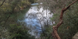
New Book on Coups Creek
Frances O’Brien worked as the Environmental Officer at Wahroonga Waterways Landcare for four years and has written a book about this E2 zoned conservation area. It covers an area along Coups Creek that is the headwaters of the Lane Cove River. It includes stories about the native flora and fauna, conservation work and history of the site. It is 96 pages, A5 with a fold out A4 walking trail map. Cost $21 plus postage.
This bushland land area behind the SAN hospital has improved remarkably with the large number of volunteers working on rehabilitation.
Contact Frances at This email address is being protected from spambots. You need JavaScript enabled to view it. for more information.
Lane Cove National Park to Gain some Land near M2
Lane Cove National Park will be expanded, albeit marginally, with the addition of 0.6 ha near the river at North Ryde near the Epping Road bridge below the business park.
The announcement from NSW Environment Minister Gabrielle Upton states that it will help foster habitat and threatened species along the river. The threatened species include Darwinia biflora, a shrub only found in Sydney’s northern suburbs. Weeds are a problem in this area because of the steep terrain.